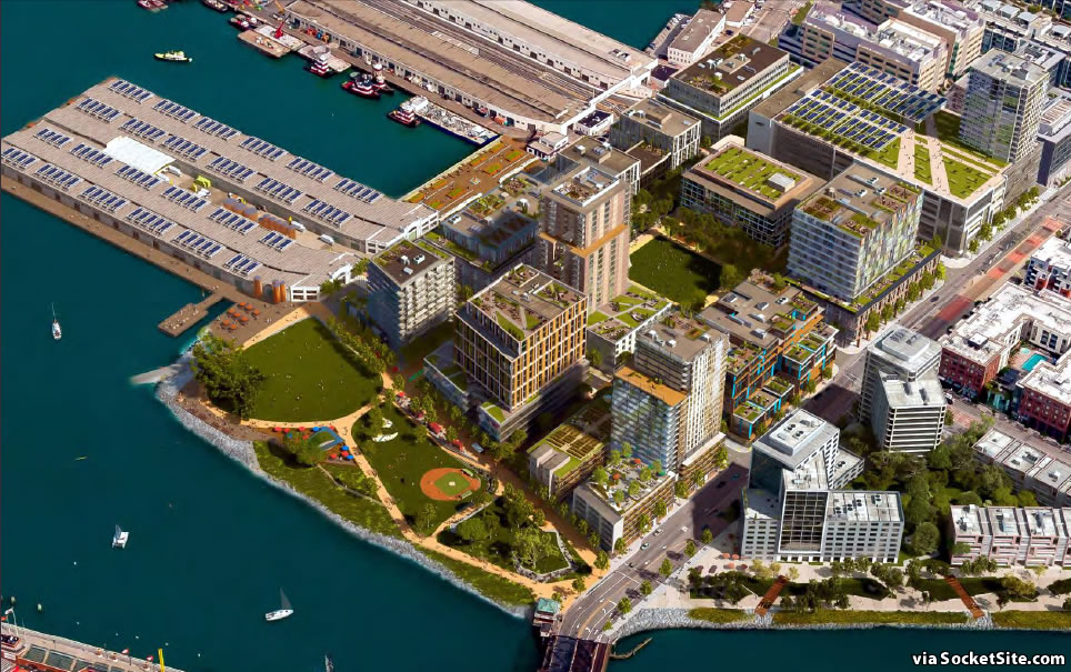
The conceptual design for the San Francisco Giants’ proposed 28-acre Mission Rock project, which is slated to rise up to 240 feet in height on San Francisco’s Seawall Lot 337 (a.k.a. AT&T Park’s Parking Lot A), has been refined, rendered anew and is slated to be presented to San Francisco’s Bay Conservation and Development Commission next week.
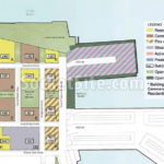
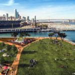
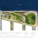
At full build-out, the proposed development would yield 1.4 million square feet of office, retail and commercial space; 1,500 units of rental housing; 3,100 parking spaces, including a new parking garage at the southern end of the project; and 8 acres of new or redeveloped public space/parks, including a redesigned China Basin Park at the northern edge of the site, with a great lawn, play area and new plaza.
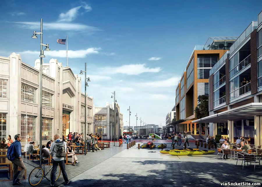
As envisioned, the east-west portion of Terry A. Francois Boulevard along China Basin Park would be eliminated, and the north-south section would be converted into a curb-less two-way pedestrian-priority street that would also accommodate truck traffic serving Piers 48 and 50.
And speaking of Pier 48, we’ll note that formerly announced expansion of Anchor Steam Brewery upon the pier is now being referred to as “a potential tenant” rather than a done deal.
In all, rather disappointing given the potential.
If your line had followed a long elaboration on exciting alternatives to this site and a specific analysis of the current proposal’s shortcomings, you could have won me over. In this case, I’ll take the plan above anytime over the existing parking lot.
And what is the potential? Is it more comparison to other cities, using the overworked term of “world class”, or another solution you had in mind?
Agree. I give architecture a grade C. Looks like new neighbors with big glasses looking down on old neighbors. But then again these are schematic drawings. Eventually each building will be awarded to different architects who will have their go at it; but only to be “value engineered” given the skyrocketing cost of construction.
Also dont really like the fact Terry Francois is a wide boulevard and it gets narrow down at where it will have its highest pedestrian traffic area. This corner gets heavily congested during Pier 45 special events. Thousands are let out at this corner. Need more elbo room; setback buildings further. Also space feels choked or proportion seems awkward.
What? New designs? These are the same ones from the website that they had when they won at the ballot.
Surburbua 1978. Anyone home? Looks like derivative group uninspiring work. Snore.
doesn’t look much like Suburbia 2016 where I live
Don’t think it looks anything like suburbia in 1978 either
Technically the comment says **Surburbua**. From “sur,” meaning “above” or “in addition,” and “burb,” slang for “suburb,” this is what existed above and in addition to the suburbs in 1978: that is, height and density.
Or maybe I’m trying too hard, and invented’s comment was just silly.
The most interesting thing about this is clearly the park. AND, that there is a four foot rise to the center of the site to respond to sea level rise. Effectively, all the new building will be built to be “safe” from that rise, although without further work it would become an island.
It is certainly a shame that sea level rise was not considered when the rest of Mission Bay was planned, because Mission Bay is one of the largest undefended areas in San Francisco, and of course the most recently developed.
They are going to need a lot more than 4′ in Trump’s America…
“Trump’s America” should be severely truncated. I do believe a secessionist movement of the Coastal Western states should be seriously pursued. How about an exploratory convention to gather in Portland January 20, 2017?
Orland, thanks for the pure comedy! How would Southern CA get water from other states if it left the U.S.? Answer: it wouldn’t.
Also, how likely is it for there to be a constitutional amendment granting secession – an amendment that requires approval by 38/50 states? Answer: impossible.
Nothing comedic about it. Time to unburden the World of the f’n USA. The USSR managed to do it, we should have started the process a couple of decades ago.
There is absolutely no need for a Constitutional amendment for a peaceful secessionist realignment.
Water? Money and wherewithal till we put in place the Pacific NW Waterway to hook up with the California aqueduct system. Would immediately be one of the leading nations on Earth.
I suppose the ginormous parking structure is for giants games?
That is correct. Have to have some sort of parking for your VIP/club/ Suite ticket holders. Those types demand some sort of dedicated parking.
There had been comments in earlier items on the subject to the effect that there will be no on site parking dedicated to Giants games attendees and they would have to compete with residents as well as patrons of the retail elements as well as employees of the commercial uses.
I can’t vouch for their veracity or whether still the case.
No other parking for game attendees? That sounds whack. OTOH I’d be cool to be a resident with parking, and make some $coin$ on the side renting out your spot during ball games? Like back in college daze when your stand with a cardboard sign outside before the big game pawning your parking spot? (Maybe not 😉
This looks fine to me, much better than the parking lot that exists today. Reminds me of the newer development I saw in Oslo, Norway. No need for skyscrapers, the mix of mid-rises and some 240′ towers seems balanced. I love the amount of open space and hope that there is enough retail/restaurant space to keep the area active outside of baseball season. This and the Chase center will be a great addition to Mission Bay, build it!
“I love the amount of open space and hope that there is enough retail/restaurant space to keep the area active. ..”
I disagree and think that self-contradictory. There is plenty of park land fronting the channel west of Third Street (Willie Brown Blvd) and I’d rather see more urban uses (restaurants, clubs, hotel, condos) directly on the water with tie-up access for boats. A lavishly landscaped thoroughfare behind them and the interior quad would provide plenty of greenery for the project IMO.
We can agree to disagree, not everyone sees things the same. The parks proposed would provide a great public space, in addition to the area surrounding the channel, and this development’s retail/restaurant spaces will hopefully create some year-round “eyes on the streets” (ala Jane Jacobs) versus becoming a bedroom community. Regardless, I am excited for this to proceed and as I am in my 20’s, perhaps it will be completed before I’m 60.
Would also like more marine recreation at the Pier with restaurants you can canoe or tie boat too and the Piers to be more lush. Two problems: 1. waves are too rough. 2. SHPO state historic board reserves piers for maritime use and does not allow landscaping, the later is “not historic”. Office, restaurants, housing not maritime business.
Protectionist rules are archaic and need to be updated to current times. SFPort funding are suffering under these rules. BTW there is no longer plenty of parking at Channel St.
The way San Francisco works, Buster Posey will be collecting Social Security before this is built, unfortunately.
Or the whole site will be under water.
Definitely looking to see how they reinforce and double up on the foundations. Going to be a hot issue going forward considering the Millennium Tower, and this one practically on the water already.
There are no reinforced concrete towers in this plan.
What happened to the McCovey statue?
…and the Giants history walk! I bought one of those tiles and don’t really want to see them move or even get rid of it!!
Where is the 240 feet?
See the second image in the first gallery, or perhaps the “slated to rise up to 240 feet in height on San Francisco’s Seawall Lot 337” link, above.
Does anyone know what the planned foundations consists of? And how resistant they’ll be (if at all) to either of earth-quakes + sea level rise?
B/c a lot of mission bay is fill I’d suspect a high soil liquefaction risk.
Though I’m neither a structural engineer nor a geologist.
I think soil conditions is one reason why a lot of mid rise developnent. Lots less weight and easier & less costly to build on existing conditions
The foundations for the adjacent buildings that have been built go down 225′ feet. Watched them pound the piles for the public safety building – first 100′ down is very soft bay mud…..
And Warriors?
I think mission development is probably a lack of a strong transit plan going forward which I put more on Mayor Lee. His office pushing to spend millions more to reroute and bury Caltrain, knock down 280 seems like a unrealistic plan and won’t address recent development for foreseeable future as Mission continues to build out.
But, there’s the T line, right? One car trains that can whisk thousands of people all the way to Chinatown every 3 minutes.
I’m a bit worried about that last remark about Pier 48 Anchor Brewery restaurant. That’s a very exciting part of this Giants plan and I sure hope they follow through and convert those piers for Anchor Brewing Co.
Yes, I was also looking forward to the pier being repurposed by Anchor. In fact, I’d love to see them take over the naming rights — Anchor Field at China Basin just sounds so right. Their logo atop the center-field scoreboard would also be immediately iconic.
The parking structure for ATT Park should be incorporated into the Warriors parking structure at Pier 80. Increase Muni to handle the volume. Traffic is a disaster especially during day games. I love the development other than the parking issue. The Mission Bay streets were never designed for this traffic load, they need to think out of the box on this one.
Hilarious how the Giants always show renderings that hides the heights of the towers. Obviously they are afraid of public backlash. Show a view from ground level that shows the full height of the development!
Building and design at the right bottom across the street from the rendered buildings is in construction and looks VERY cheap and low-quality in terms of detailing and design. FYI
Are you talking about One Mission Bay? Probably the sorriest excuse for mid-rise architecture that I’ve seen since…well…everything else in Mission Bay.
Pity they’re going to let them build so close to the pier facades.
Really? I’d say that’s one of the nicer things about it. If there was more space, what would you put there? The Embarcadero is wider, but it has six lanes of cars and two streetcar tracks.
Agree, San Fran remaining pier structures and desire to build a linear waterfront park is an awesome assets.
Can anyone make any sense out of these last two comments? If so, please translate.
Agreed too close. Mission Rock’s version of walling the waterfront. Feel sorry for the operators leasing pier 50 who need to drive in their super-oversize equipment. That includes the army who has two ships dock at the end of Pier 50 for emergency deployment.
Please explain the logic of a 9(?) stories parking structure topped by a 24 stories tower, across the Safety building, fire Department and Police HQ, and with an entrance either on Third street (not going to happen) or on a traffic restricted street because of the Safety building? That is insane!
UPDATE: Impact of Giants’ Massive Mission Rock Development Revealed