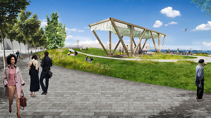
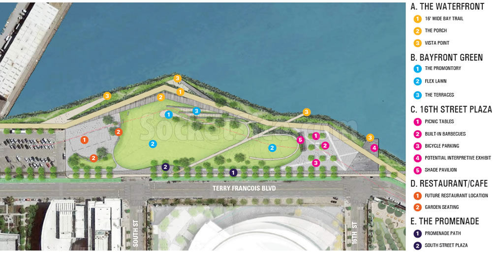
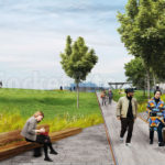
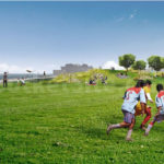
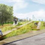
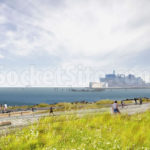
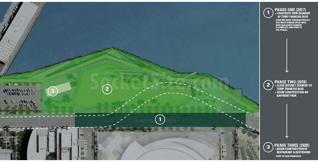
San Francisco’s future 5.5-acre Bayfront Park, which will be bounded by a realigned Terry A. Francois Boulevard and the San Francisco Bay, between 16th Street and Nelson Rising Lane, across from the Warriors’ future Chase Center arena in Mission Bay, has been newly rendered and detailed.
As conceptualized by Surfacedesign, the proposed park includes a 16-foot-wide shoreline path connecting San Francisco’s Blue Greenway; an 18,000 square foot plaza at the terminus of 16th Street, with built-in picnic facilities; 60,000 square feet of landscaping and lawn (the Bayfront Green); a pathway providing an east west connection from the shoreline to Terry Francois Boulevard; a series of shoreline lookouts, terraces and seating areas along the bay’s edge; a shade pavilion at the southern end of the Green constructed from reclaimed Bay Bridge steel; and a pad for a new 7,500-square-foot restaurant, with public bathrooms and an 8,500-square-foot of outdoor dining area, to be developed by the Port.
In terms of timing, while the realignment of Terry A. Francois Boulevard is slated to get underway this year, the park isn’t slated to break ground until mid-2018, with a projected opening in the third quarter of 2019.
And the Bayfront Park restaurant and restrooms are expected to open a year or so after the park, at the earliest.
capitalizing on the popularity of bocce ball
[Editor’s Note: The plans do not include any bocce ball courts, as far as we know. But they are practicing yoga under the shade pavilion in the rendering above.]
It’s great that this green space is finally getting done. Given all the new development, the City has not spent enough on new parks.
There will be some lovely views of Oakland from this park. We might even be able to see the new A’s ballpark near Jack London Square.
It’s really too bad that Oakland is so economically dependent on their port. If only the city could shut it down and redevelop all that property they’d have a real waterfront, instead of the little postage stamp wedged between a freeway and Alameda that is Jack London.
Shut it down and move it where? Please advise where the 40 Billion dollars of goods that come through Port of Oakland every year should move to?
Exactly my point. That port isn’t going anywhere, and will continue to lock up the prime waterfront land.
You say the port isn’t going anywhere, but the goods that are received by container ship certainly are, They are shipped by truck and rail all over the United States. Oakland has a working port that provides jobs and income. It is a real port. It does what ports are supposed to do The waterfront land isn’t “locked up”. Except for cruise ships, San Francisco’s port is pretty much gone. It’s waterfront just sits there and looks pretty.
Speaking of which, now back to the topic at hand: Bayfront Park and its environs (or at the very least, San Francisco’s Blue Greenway).
If by “sitting there and looking pretty” you must mean that SF’s waterfront is a local, regional, and international destination and massive job/income generator for its many events, businesses, facilities, etc. And now the Warriors are adding to that list.
And it probably shouldn’t go anywhere, because I suspect there’s more value in being the one major cargo port in the Bay Area than there is in trying to be the 17th “destination”. If everyone’s chasing the same visitor dollars, everyone will lose.
Are there not plans for a ferry terminal at the foot of 16th Street? How does it fit into this picture?
The ferry is planned just south of this new park, at Agua Vista park (next to Mission Rock Restaurant/Resort).
[Editor’s Note: Mission Bay Could Have Ferry Service Come 2022.]
So Agua Vista is staying in place? I thought it was a lost cause (or, at least, I figured that’s why they cut down most of the pine trees).
Agua Vista will remain. It is located immediately south of the “Bayfront Park” 16th Street plaza. The Port has plans to do some upgrades and renovations there too, including a possible water taxi pier, and a ferry platform to serve the neighborhood.
Believe it or not, actual construction has finally commenced on long-delayed Crane Cove Park just further south.
Thanks for the informed response. Any info on the progress of the timeline as set out in the link?
Oakland has a pretty great Middle Harbor Park. Also there are Emeryville Marina, Ceasar Chavez park in Berkeley, the shoreline along Alameda etc. Not sure why you feel it is lacking.
MHP is nice, but good luck walking there. You can only get to it by driving through the bleak industrial wasteland. And I was only talking about Oakland’s lacking waterfront, not the other cities.
Oh’rita, you’re being such a snark. The port is not an industrial wasteland -it’s the 5th busiest port in the US and it’s seeing hundred of millions of dollars in investment right now. I spend a few afternoons a week along some section of the Oakland waterfront and the last thought that comes to mind is it’s wedged between a freeway and an (man-made) island.
The whole park is part of the Blue Greenway. The trail portion is a key connection to the SF Bay Trail.
It will be awesome once Crane Cove and the other projects along the east waterfront complete and provide a continuous path. Imagine strolling from Bernal to Dogpatch and then along the waterfront to the Ferry Building on a nice weekend.
Personally I’ll miss the atmospheric decay of the old industrial area but this transformation is a big win for the public in general.
How long until this park turns into a homeless encampment?
Yeah, let’s make it a fenced-off, uninviting parking lot so that no homeless people can come near it. Way to do town planning!
[Editor’s Note: Unable To Solve Homeless Problem, City Will Erect A Fence around the new McCoppin Hub Plaza and open space (which remains padlocked as of today).]
McCoppin is hardly an inviting public space – geese, the damn freeway sits right overhead! This park will offer attractions for the many visitors and residents of this area. And yes, there’ll probably be a few campers. Maybe the City needs to start charging them cash-rent for certain destinations.
There are geese there? Yikes, those birds can be mean.
Geez-us (autocorrect that!)
FWIW, there are very few homeless campers there now. I guess there could be more in a few years but I’m not sure that would be the result of the park’s construction.
Nice addition to this area. When the Arena opens, it will make a great area .
Noted that the scheduled 3Qtr. 2019 completion of the park would coincide with the projected opening of Chase Center for the 2019-20 NBA season.
Its too bad they couldn’t/didn’t underground TFB and the intersections at South and 16th so they could run the park all the way up to the arena property.
water access?
Yet another development without play structures for kiddos. Such a missed opportunity! I’ve travelled the world with my kid and San Francisco is one of the most kid-unfriendly city we’ve been to because there are so few places for kids to play – for free. A wide open green field doesn’t cut it. Look to Chicago’s amazing Maggie Daly Park for some ideas. Please!
They literally just opened a large new playground just for kids and playgrounds in Mission Bay last summer, about three blocks from this waterfront site. Also: Maggie Daly Park in Chicago is amazing. I love it, and wish we had something like that here. But other than that, you don’t really know what you’re talking about: these two sites are not comparable. Maggie Daly Park in Chicago is a 20-ACRE parcel, and is just one piece within a magnificent 319-ACRE PARK. Mission Bay’s Bayfront Park is a less than 6 acres. Waterfront parks cost real not just in construction cost, but in lost real estate value, and in maintenance costs. San Francisco’s Port has failed to invest in its waterfront open spaces for years; the southern Embarcadero and the other southeastern waterfront open spaces are mostly a shambles.
You should also know that playground structures in Bayfront Park were explicitly *prohibited* by your San Francisco Bay Conservation and Development Commission. If you want to see more vibrant waterfront spaces, like active playgrounds for kids, or roller skating or outdoor concerts, start with reforming BCDC. It is their mission to prohibit all of these activities, wherever they can, anywhere along the Bayfront, and they’re doing it in your name, supposedly for your benefit.
Piers 30-32 would make a magnificent location for a Maggie Daly-like park. Develop the seawall lot across the Embarcadero to its highest possible use to help pay for the refurbishment of the piers.
[Editor’s Note: The Likely Fate of San Francisco’s Prominent Piers 30-32]
Agreed, but who will pay? The Port has no money. Rec& Park has no money. The only reason the Port developed the Brannan Street Wharf was because the Port struck a deal with Lendlease to contribute $18 million into a fund for development when it was allowed to build the Watermark. The additional $8 million came from other sources like state and federal grants.
And by the looks of the condition of the park the Port is just doing triage to maintain the Brannan park.
This new park is going to be a major BIG hit! The reason, weather. This part of San Francisco has the best weather in the city. It’s sunny and warm most of the time when the rest of the city is fog bound or wind swept.
Also, I believe the park will be developed using Mission Bay Mello Roos development fees and will be maintained by the Mission Bay authority and not the Port or Rec & Park.
Rec & Park and the Port have no money to maintain nor construct a park like this. I believe is was all part of the master plan for Mission Bay while SF Redevelopment was negotiating the land entitlements with Catellus (sic) or whom ever owned the property during the entitlement process.
What happens to The Ramp restaurant?
that’s not where the Ramp is located
See: New Timing for San Francisco’s Crane Cove Park and Shoreline (which specifically includes The Ramp).
UPDATE: Timing for New 5.5-Acre Bayfront Park Pushed Back