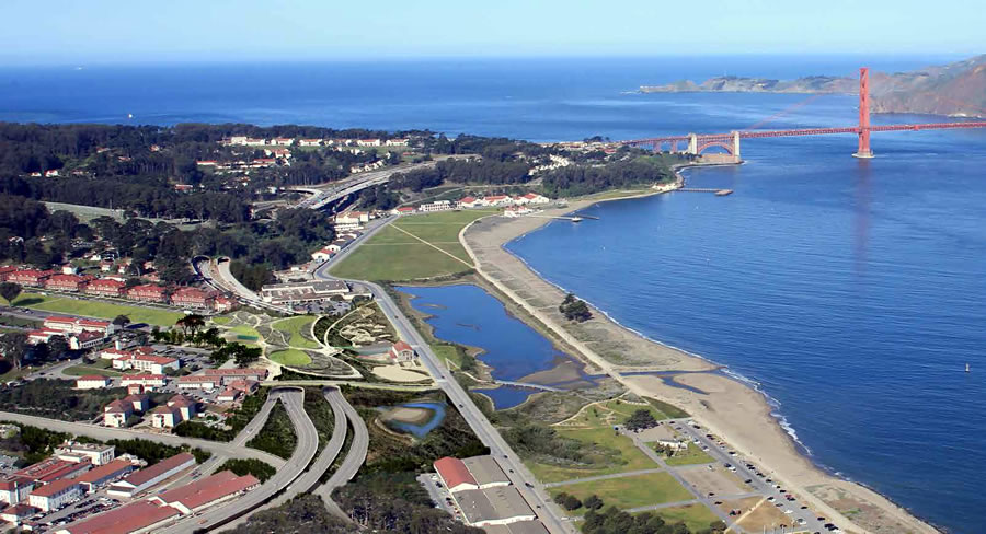
The detailed concept design and schematic for the New Presidio Parklands Project, which will connect the Presidio’s historic core to Crissy Field and the San Francisco Bay for the first time in over eighty years, was released last month.
From James Corner Field Operations, the lead architects of the 14-acre project:
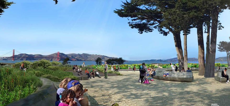
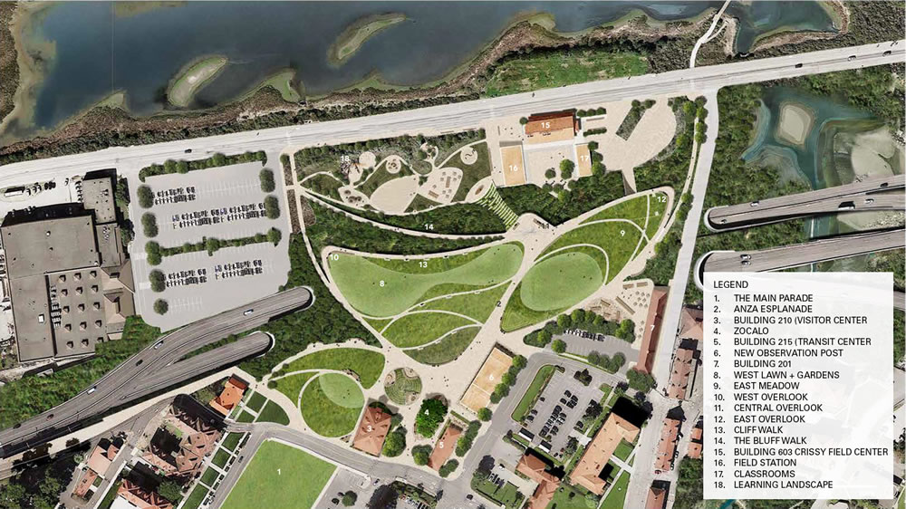
With the creation of this new park on the tunnel-tops, the view from the Main Parade is now fully open and unobstructed. A series of lush gardens and meadows extend from the northern end of the Main Parade, and are punctuated with pathways for strolling and intimate nooks for seating and small gatherings.
The plan also shows an extension of the Anza Esplanade, connecting the Presidio hills and the Main Post to a “Central Overlook”, a central viewing and gathering point from which to experience the magnificent views to the Golden Gate Bridge, the Bay, the Marsh, and the City. A new “Zocalo” functions as a main social and multi-functional arrival and gathering plaza between the Transit Center and the Visitor Center, and makes a central feature of the existing Monterey Cypress trees.
The existing observation post will be demolished and a new observation post at the eastern boundary of the project is being studied. A new “Cliff-Walk” wraps the edge of the embankment and connects visitors to the many points of prospect, views and connections to the wider landscape. The Bluff Walk connects down to the Learning Landscape, which includes a renovated Crissy Field Center and a new “Field Station.”
The concept design for the New Presidio Parklands Project will be refined over the next year, with construction slated to commence in the fall of 2016 and be completed in 2018.
A tip of our hats to the veterans who either served or are buried in the Presidio, and to all our veterans, past and present, around the world.
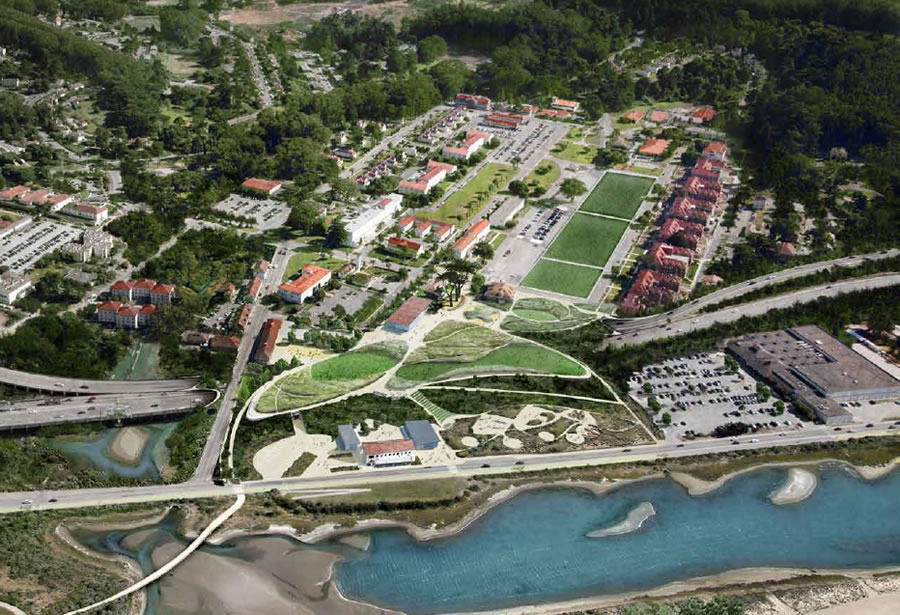
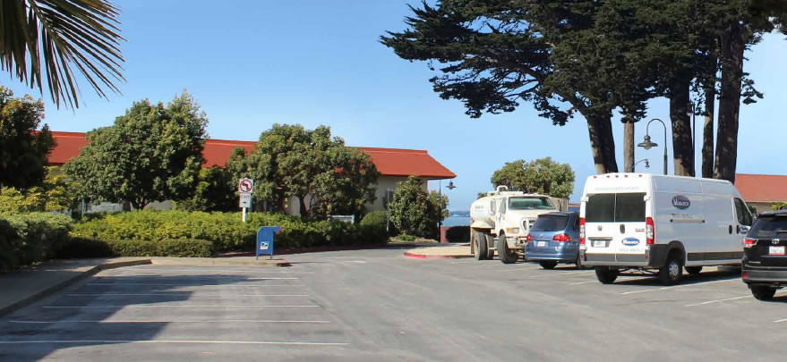
Any update on the Sports Basement site and how that ties into the Presidio Parklands project?
judging from the rendering immediately above, it looks like the building and parking lot are unaffected. I’m not sure if their lease was extended though. let’s hope so!
I thought the Sports Basement were planning on moving into space further east on Mason Street.
[Editor’s Note: That’s still the plan (as far as we know).]
great – I wonder if there is any chance of the streetcar line making it here? Seems a little ironic that most people will take their car here to experience the new direct car-free park connection across the ex-doyle-drive which was built for cars in the first place.
Doubtful (although I’d love it). I think it will terminate at Fort Mason – extending it further west would draw the wrath of the local Marina NIMBYs.
They’re fighting even the proposed extension to Fort Mason.
Jesus. This is why we can’t have nice things. We kowtow to cowards and the most reprehensible, self-absorbed, selfish members of society.
Hey, don’t bring Peskin into this!
🙂
Orland, any more information on this? I can’t find any information past 2013 regarding the extension.
It’s going to happen regardless. With the new SF Subway Master plan coming together this will be one of the improvements being considered. What we don’t know is when this will get prioritized and funded.
All I know is what I was told by docents at a couple of Market Street Railway functions. When asked about the status of the extension, they expressed the understanding that things were “on hold” as there is litigation brought by Marina interests.
Looks awesome
This is looking to be a truly GREAT urban landscape and roadway plan linking the Presidio to perhaps the most beautiful shoreline in San Francisco.
But the Sports Basement has got to go. A commercial enterprise with a big parking lot has no place in this plan.
It’s not part of the plan.
I would like to see a car free presidio at least one day on weekends, similar to GGB.
Its refreshing to see the simplest scheme for developing this site winning out in the end.
Not covering more of the highway is one of those multi-century mistakes one rarely gets to make…
Hmm, given that the original Doyle Drive only lasted 78 years… and it’s hard to see what would stop them from adding more tunnel cover in the future if they so chose… I don’t think this is where I’d wring my hands over a “multi-century” mistake.
Adding a cover will not alter the mistake of the level of the roadbed. Lowering it in some future rebuild will be very, very expensive.
It’s true, if they realize the error of their ways, that some future tunnel cover between the existing ones might be lowered a few feet (not enough to get it out of sight) and that, eventually, when the existing ones need to be replaced, the replacement will be lowered.
But that ain’t gonna happen.
1. I hope they open a basic path to connect the Main Post and Chrissy Field in advance of the rest of the project. As it is, it’s a long detour around it.
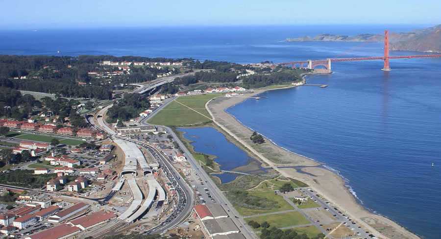
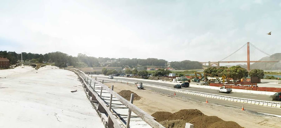
2. Looks like they’ve managed to erase the massive concrete wall in the rendering, which is so prominent when you’re on Mason St. looking north toward the freeway. Wonder how they’re planning to do that? My suspicion is that there are no plans, and the rendering is unrealistic.
It looks pretty prominent in the final rendering above.
I’m thinking of the aerial view looking south, second image in the post.
There’s definitely something weird going on. The southern tunnel should be wider than the northern one, and the freeway at the western end should look even wider because of the concrete wall. But in the rendering, the western approach of the southern half looks like it’s the narrowest of the bunch.
I know!!!! A MURAL!!!!!
Maybe they should paint it green. Call it a green freeways initiative.
The Presidio Trust was unhappy with all three finalists’ first proposals at the Sports Basement site, including the design of the Lucas museum, and asked for revisions.
The resubmitted proposals varied in tack — for instance, Lucas’ team redesigned the building but kept it the same size and the Presidio Exchange team kept the same design but shrunk it down by roughly 50 percent.
The Trust then made the bold decision that none of the projects were good enough for that prominent site.
Still, I agree Sports Basement should go as soon as possible.
Why?
Seriously? Because it’s ugly and could be relocated to virtually any place else yet is in about the most inappropriate place imaginable.
Yes, I was serious. Sorry for asking such a silly question and thank you for putting me in my place.
With the creation of this new park on the tunnel-tops, the view from the Main Parade is now fully open and unobstructed.
No, it’s not. You can stand on the Parade near the northern end and the tops of the tunnels are very clearly visible and rise into your field of vision, and that’s before any covering is put over them. A roadbed a few more feet lower or a flatter, less tall tunnel opening would have avoided this result. Pity.
Why is the tunnel opening so tall? Are they planning on double-level at some point? A BART train track above the cars?
Caltrans tunnel min vertical clearance over a roadway is about 16 feet. Eyeballing these tunnels, they look like they were built to about the standard. FWIW, double decker buses are allowed to exceed 14 feet in height on CA roads and some fire engine/first responder vehicles are nearly that high.
Looking at more photos, I guess the opening isn’t as big as I thought. It’s a long way down looking from the wall at the edge of the Main Post and my sense of perspective must be off (or my memory, since I was just there on Sunday).
Regardless of their height, though, it’s a mystery to me why the roadbed wasn’t lowered more so that the covered top was no higher than the parking lot and street at the northern edge of MP — one of the tunnels is already that low. The truly uninterrupted view would have been amazing. And it if had extended all the way from west of the National Cemetery to the east end of the marsh, instead of being broken up into two sets of double tunnels, future generations would have thanked us.
Are both tunnels to be covered?
Both tunnels are covered in two places: 1) in front of the National Cemetery (in the top photo also covered with trees that aren’t there yet) and 2) in front of Main Post.
Thanks for the clarification. Those mature trees aren’t going to be there for 25 years.
I disagree – do a Google street view; the tunnel interior height is about equal to two lane widths (which should be 12′ each), for a total height of about 24′ – which seems to jibe with the fact that there is signage hanging down from the tunnel ceiling, so for there to be 16′ clearance to the bottom of the signs, the interior tunnel height is that much higher. Then the tunnel covers themselves look to be feet thick, which seems a little odd since all they need to carry is a static load of some dirt and veg.
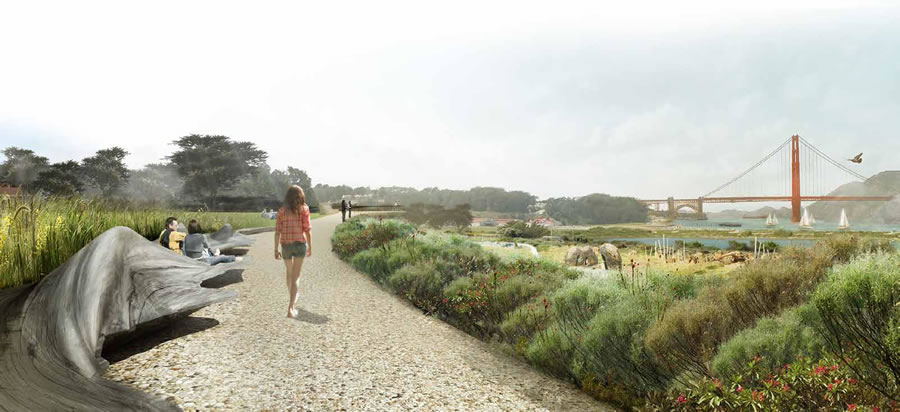
Looks nice though I hope the Blob doesn’t eat that girl.
I love it and look forward to long strolls here in the near future.
I’ m still sad to see so much open lawn space, which is a b*tch to maintain and uses a lot of water. The great lawn at Crissy Field is rife with gopher holes and hummocks, making it unpleasant to walk, play, or sit on. I really preferred the design that relied on more naturalistic swales, bluffs, and native plantings. Hopefully some of those elements will be incorporated here.
Agree, they need to get rid of the stupid waste of chrissy field, (dog-poop palace) and figure a better way to look at the historical aspects of the light-rail line that served the 1915 pan American exhibition line… would solve the transit issues to the presidio currently…
i love Chrissy field as is, as do many many SF residents. Unsure why people would not like it.
No need to be sad about them maintaining it, since they’re not.
See that long roadway at the bottom and right of both pictures. There should be a light rail there, or F-Line Extension from Ft. funston, carrying out from the downtown to the Golden Gate Bridge. It would be called PUBLIC access to a PUBLIC PARK…. Do it on a bermed hill with the transit on top and you would be dealing with future sea-rise as a dyke system along the waterfront, with canals like in Amsterdam on the inside edge, with new housing and of course development… Would pay for the light-rail, and you would still have the bermed hill on the opposite side, to sit, look out and daydream how the future of SF will look like…