The development of a long-term vision, design and implementation plan for Ocean Avenue between Manor Drive and San Jose Avenue is underway.
Building on a number of studies, designs and plans which have already been completed for the area around Balboa Park, the Ocean Avenue Corridor Design project will identify near-term streetscape improvements that can be implemented between Manor Drive and Phelan Avenue while developing a longer-term plan for Ocean Avenue stretching from Phelan over I-280 to San Jose Avenue.
The first round of conceptual designs and a detailed implementation scheduled are slated to be ready in July, after which the Department of Public Works will begin preparing Ocean Avenue between Manor and Phelan for construction, funded with dollars allocated from the Road Repaving and Streets Safety Bond.
∙ Ocean Avenue Corridor Design: Project Area [sf-planning.org]
This strip looks better every year, Whole Foods is the Atlas holding up everything else.
Seems like a lot of the Mom & Pop stores are turning over. 1970s hobby shops are disappeaing, we’re getting doggie hotels and yoga studios instead.
This area has a lot of potential. Many nice detached houses in Westwood Park and Ingleside Terrace that many have never seen. My wife and I considered the area but I can’t get over the weather myself.
We’ve noticed an increase in foot traffic along the corridor btw Lee and Victoria, but that’s just “anecdata.” This area is extremely transit-connected for an outer neighborhood. It would be nice to see measures taken to calm traffic a little – the crosswalk at Geneva is terrifying.
As for the coming and going of establishments, I would appreciate more newcomers like Champa Garden instead of more pot dispensaries (do we really need three within a five-block stretch?). Just happy that Ingleside Barber Shop has been alive and well for 25+ years.
The only really necessary improvement is razing that stupid church.
So disconnected. Stop wasting money.
1. Upzone (or stop the hollow housing chatter)
2. Connect MUNI to SFSU and the to-be expanded Park Merced
3. Improve as part of a coordinated process.
These needs to be an integrated process.
The neighborhoods off of Ocean have really interesting housing, topography and communities and need a bold integrated approach to the corridor’s future. Don’t piece meal this.
@ Invented – actually the M-line upgrades are fairly far along in the (interminable) planning and review process. The plan is to tunnel small portions in these neighborhoods (good), to divert to run through Park Merced (good), but to remain on the surface for most of its run along Junipero Serra (bad) and *not*, in the near term, to connect to Daly City BART (stupid).
Thanks — what about City College to SFSU — muni, protected bike lane, etc. Huge institutions that are so close but seem separated by transit. If I’m a student at SFSU, can I hop MUNI to Ocean BART? Maybe I’m missing something.
Palm trees AGAIN!?!??
The corridor was repaved and landscaped with trees and bulb-outs under Willie’s tenure, so I’m wondering what changes are in store. Certainly they should focus on the larger long-term improvements (separated K-line right of way perhaps?)
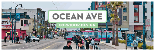
I really like the banner photo they used – it juxtaposes the new and old elements of the corridor quite nicely.
If the weather REALLY bothers you about these up and coming neighborhoods, then stop complaining about housing costs.
Fantastic! I moved to Ingleside within the past year and have been really excited about all the changes going on. Keeps getting better and better.
New restaurant Champa Garden is fantastic. We need more of those types of establishments, and less Yogurtlands :0
“that stupid church” is the El Rey Theater, designed by Timothy Pflueger and an architectural treasure. I would prefer another occupant to the Voice of the Pentecost…
@Invented – Yes the M line ends at Balboa Park. If you really wanted to you could switch to the K to go up Ocean or you could walk which is what most people do
Urbano (great street) used to be a racetrack. http://foundsf.org/index.php?title=A_Lap_Around_the_Old_Track
This hood is ripe for hipsterfication. The Pission is so not cool anymore.
Does anyone know what the so-called boundaries of the “pneumonia belt” are? And is this in it? ( you don’t here this phrase used much anymore, but in the 80s/90s it was the term for the far western side of the city I think. )
Thanks for the history trivia Invented. I find that stuff interesting and especially historical uses that affect street plans and parcel boundaries.
@EH & @EJ — the retail building on the right side of “that stupid church” is also the location of the original Gap store. Seemingly hard to believe that they’d ever operate in this neighborhood now, but here it is: http://www.outsidelands.org/images/gap-store.jpg
Agree with everyone that this corridor has some of the most potential of anyplace in the city. Nice housing, great bones, good transit infrastructure.
That stupid church was once the El Rey Theater and yes, the first Gap store was on its property. The K was built to serve Ingleside and the M to serve what became Stonestown, SF State and the Ocean View district. It was extended to Balboa Park Station, so Muni Metro serves both CCSF and SFSU indirectly. But I doubt that Muni will extend tracks down Ocean Ave. to connect K and M at Lakeside Village.