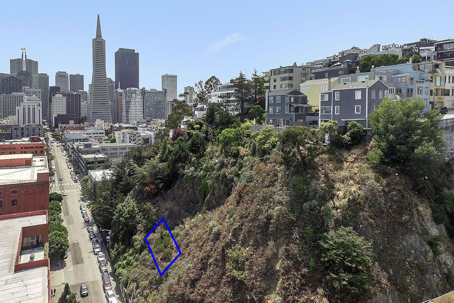
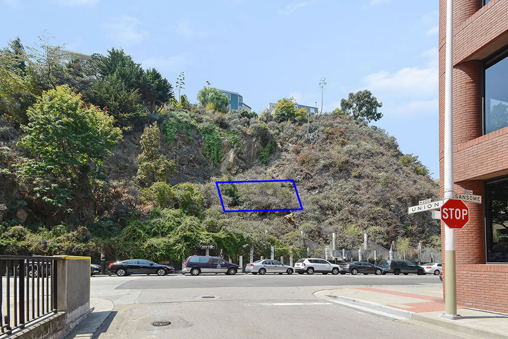
While zoned for development up to 84 feet in height, the 1,470-square-foot Telegraph Hill lot at 202 Union Street is located along a never developed extension of Union, 20 feet above Sansome Street, in the middle of the hillside with a 35 degree slope and surrounded by other properties (including the lots which front Sansome Street, plans for which have been drawn).
And having hit the market positioned as a “fun way to buy a Prime piece of San Francisco Real Estate,” with a fun $150,000 price tag, the hillside parcel at 202 Union Street has sold for $100,000 with the listing agent having represented the buyer as well. We’ll keep you posted and plugged-in.


I wouldn’t own it if you paid me $100k. This is a major liability.
How many lots are there on that slope?
There are at least ten undeveloped parcels, of various sizes and of which we’re aware, on the hillside between Alta and Green.
Thanks for the info!
I’m in favor of creative land use, but there’s no way you can do anything with that lot…
most likely bought as a call option on future development in that area and they are forced to buy you out.
Maybe Pacifica can start selling timeshares on that coastal edge that’s slipping into the ocean.
Was this sale on its own or in conjunction with the other nearby parcels that are/were on the market?
1,470-square-foot was probably measured the standard way of measuring the tilted parcel directly on the surface of the ground. Given that steep slope, the actual buildable size is significantly smaller, maybe less than 1000 sq.ft. Imagine either excavating a flat pad or building a platform atop piles.
Exactly. The measured depth of that lot is essentially the hypotenuse (longest side) of a right triangle, but you’d have to build on, or perpendicular to, the base leg, which is a lot shorter. I think your 1,000 sf estimate is probably close, and even with that you’d be backed up against an excavated hill or you’d have to build something on stilts.
I wonder who the buyer is.
Just a guess…perhaps the owner with plans for the parcel fronting Sansome?
how did that lot ever get created in the first place?
I think this occurred when the city street plan along with the parcels were initially mapped out during a period of high growth. Nobody really knew which parcels would be feasible to build on, so why not just carve them up and let developers figure it out? There are similar cases of streets planned to be built after shallow parts of the bay were filled in. Some of those places were made viable via landfill and were built up (the Marina for example). Others never got filled, yet the streets and parcels remain on the official maps. Davey Jones’ Parcels.
Perfect parcel for the City to buy for permanent open space.
Why bother? To reward speculators? Not like anything else is going to happen to it.
build a trail on an easement from downhill, flatten a small area, and create a new city campground (and tiny state park)!
Very curious who gets involved in a gamble like this. Looks like the transaction hasn’t been recorded yet, but the Assessor’s office values the land at $1,676, or at least they did until now.
This reminds me of the 100 or so private underwater parcels off of Candlestick Point that had some trading last year. Anyone know why someone would buy one of those?
We live in an era of people spending millions on NFTs. Compared to those NFT electronic receipts with no intrinsic value, an underwater parcel of bay mud seems positively tangible.
but there is a carry cost for underwater lots (property tax), not to mention transfer taxes. And maybe some liability risk if the land slides down or someone hurts themselves while trespassing. NFTs don’t suffer from those issues. That doesn’t mean NFTs are a better investment, it’s just that at least you can’t lose more money than you invested if (when?) the NFT goes to zero.