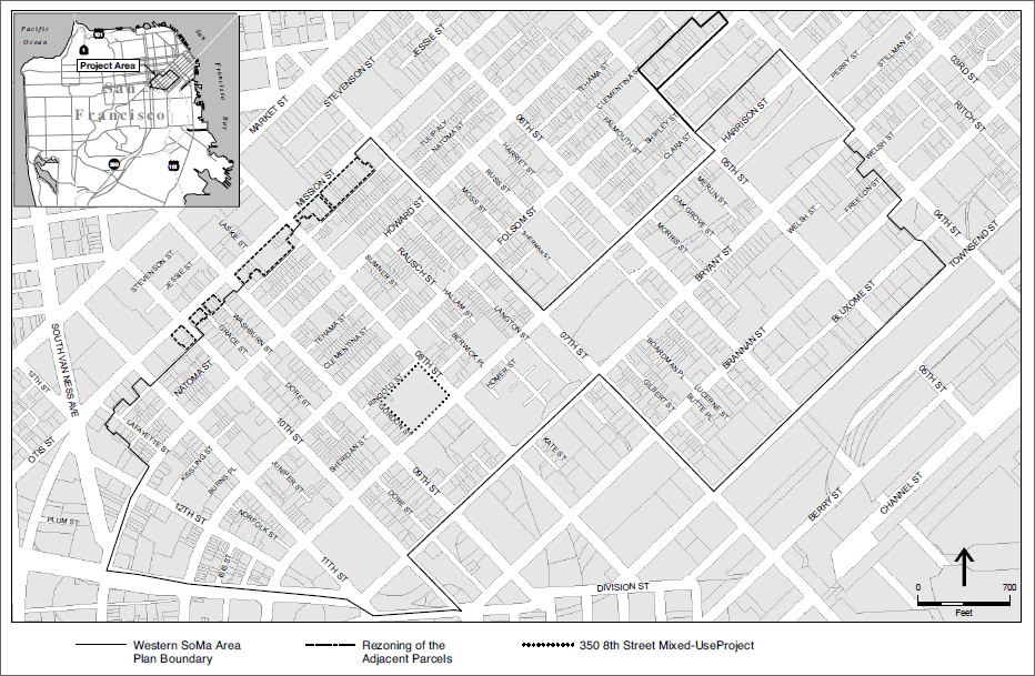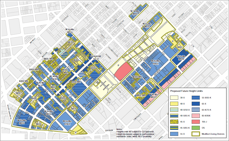
The sister project to San Francisco’s adopted Eastern Neighborhoods Plan, the Western SoMa Community Plan has been in the works since 2004 when East and West were split and the Western SoMa Citizens Planning Task Force was established.
The proposed Plan area is irregularly shaped and consists of two connected areas: one generally referred to as “north of Harrison Street,” roughly bounded by 13th Street to the east, Bryant Street to the south, Seventh Street to the west, and Minna Street…to the north, and the second area, generally referred to as “south of Harrison Street,” roughly bounded by Townsend Street to the south, Fourth Street to the east, Harrison Street to the north and Seventh Street to the west.
In general, the goal of the Draft Plan is to maintain the mixed-use character of the proposed Plan area and preserve existing housing, while encouraging new residential and resident-serving uses (including affordable housing) within the proposed Residential Enclave Districts north of Harrison Street and targeting larger parcels south of Harrison Street for local- and region-serving, primarily commercial uses (such as office and technology-based uses) and large-scale (over 25,000 square feet) commercial developments.
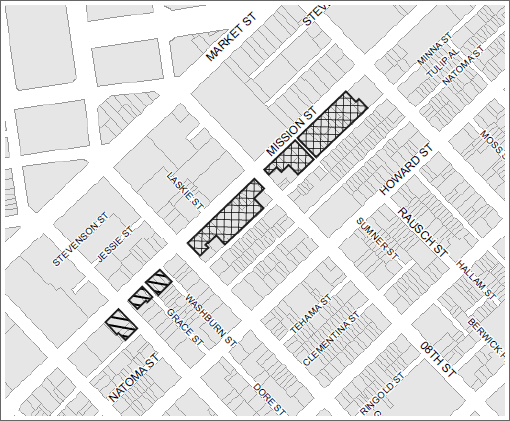
The second component of the proposed project is the rezoning of approximately 47 parcels proximate to the proposed Plan boundary (generally bounded by Seventh Street, Ninth Street, Mission Street and Minna Street) in order to reconcile their use districts and height and bulk districts with those of the neighboring properties.

The existing designations of these parcels are Heavy Commercial (CM) and Service/Light Industrial/Residential (SLR). As part of this project, parcels would be rezoned as Downtown General Commercial (C-3-G) along the south side of Mission Street, between 10th and the west side of 9th Streets; and rezoned as Eastern Neighborhoods Mixed Use Office (MUO) along the south side of Mission Street, between Ninth and the west side of Seventh Streets. No changes to the existing height or bulk districts are proposed as part of this process.
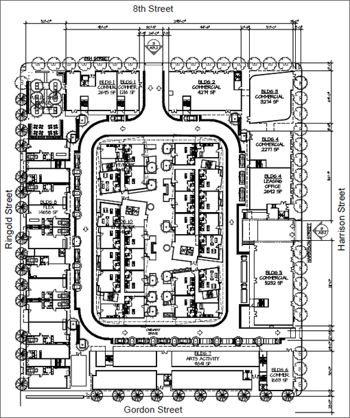
The third component of the proposed project is a privately funded mixed-use residential, commercial, and light industrial/artist development proposed at 350 8th Street, within the proposed Plan area.

The site is occupied by a large paved lot and three small, single-story administration and maintenance structures, which would be demolished to accommodate the proposed 634,000-square-foot mixed-use development.
The proposed 350 8th Street development would yield 430 dwelling units, 50,000 square feet of commercial/retail, 9,840 square feet of light industrial, 43,200 square feet of open space, and underground parking for around 400 vehicles.

I hope that this plan isn’t rendered meaningless with exceptions from the Planning Commission. Today, the Planning Commission is hearing a renewal on the entitlement for 201 Folsom Street … jury duty keeps me from showing up to bark about it. Instead of continuing to allow that parcel (which is basically the north end of the US Postal Service’s Embarcadero Postal Center lot) to fall under some special Folsom/Main Special Mixed Use something or other, they should change the entitlement to reflect it is within the 14 blocks generally considered to be a part of the Rincon Hill Plan and follow the rules under the Rincon Hill Plan. With the Postal Service moving their 100 or so letter carriers over to 550 Townsend in mid-2010, there’s no way in hell they should still be entitled to 275 or so parking spaces above a 1:1 parking ratio for residential units (so around 1,000 or so parking spots) under the notion that it is just replacement for the Post Office parking lot spaces – that’s no longer the case.
Anyway … my boyfriend lives in Western SoMa … shaping up to be a pretty reasonable plan.
Geez, after the disaster that was the northeast rezoning, one wonders how this one will go. In the northeast rezoning, the brilliant minds at planning, in an act of political subservience and utter betrayal of the mantra of highest and best use, came up with a crazy quilt of spot zoning.
The result is an insanely irrational blend of residential, abutting commercial, abutting industrial, with no roadmap for what it all means except the absurd claim that by still calling a long dormant manufacturing facility “industrial,” long abandoned uses will somehow magically reappear and preserve blue collar jobs that left the city decades ago.
Oh, and then they handed the waterfront to those taste makers at Lennar, so they could make a whole swath of SF indistinguishable from a shopping mall in Ohio.
Here in SF, we have a brand of provincialism underneath a veneer of modernism that is matched only by, perhaps, Dick Cheney wearing a pair of skinny jeans and pronouncing himself “hip.”
It’s a nit, perhaps, but I got rather confused trying to read the description of the area. I think you’ve got your east and west reversed… last time I checked, 13th St. was west of 7th St.
Anyone else get the willies looking at these district outlines? Was “Western SOMA” outlined on a property-by-property-owner basis? Districtmandering? SOMA-mandered?
wait, how does anyone work on a plan with those district lines without just rolling your eyes the whole time? There may be good content here – but talk about starting with a joke.
western soma is currently a blight in the city. this would be very welcome
I think the weird boundaries are a result of other parts of the area getting snapped up by other plans. I’ve heard Western SOMA being called “the hole in the donut”.
As far as it being a blight, the violent crime rate is lower than many nicer looking parts of the city, and I’d argue that many of the problems are the result of it being a dumping ground for social services and pot clubs, which this plan probably won’t stop.