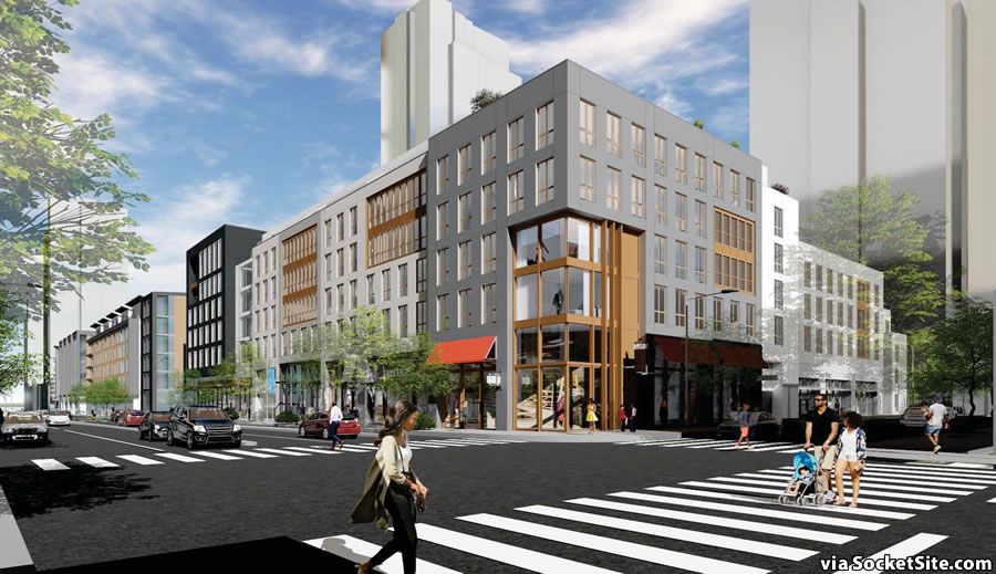
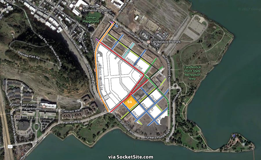
Among the very first parcels to be developed on Candlestick Point, Block 9A – which will be located between the future 8th and 9th Streets along a newly extended Harney Way, across from the anchoring Candlestick Center Commercial District – is intended to set the “sense of place” within the Candlestick Point development.
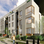
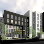
And as designed by LPAS Architecture + Design, 124 condominiums and a 111-car garage will rise up to 80 feet in height across the site, with a mid-block pedestrian paseo lined by 3 to 4 story townhomes.
Across the paseo, a 370-foot-tall tower would rise on the southern half of Block 9 fronting 9th Street (while to the east a 420-foot-tall tower is slated to rise along 7th Street). And 15,000 square feet of retail space would front Harney, between 8th and 9th.
If the plans are approved, construction of Block 9A is currently slated to commence in the Fall of 2018 and the units would be ready for occupancy by the end of 2019.
And while the overall redevelopment of Candlestick and Hunters Point will take another two to three decades to complete, the redevelopment will yield over 12,000 new or rebuilt homes, around 1,500 of which should completed over the next five years.
Why on earth will this development take two or three decades in a city starved for housing?
Instead of making more and more housing maybe we should be discouraging people from moving here because nothing gets better with more people.
I hear the Chinese have an interesting urban residential permit system….maybe we could copy that?
And, since the goons at ICE will be eager to stick it to the Bay Area, maybe they can be made the enforcement arm to make sure only “permitted” people even come within view of The City?
Papiere, Bitte?
Maybe we should encourage selfish NIMBYs to relocate instead? I hear there are gated communities in Contra Costa County which strictly restrict the wrong sorts of people.
Presume the street names (9th, C, etc.) are placeholders. Great opportunity to recognize historic San Franciscans. I’d start with Harney Way itself, since it’s the link to 101 and will be extended as the spine of the commercial/retail strip. That street’s name will likely appear on the future freeway signs (which still say “Candlestick Park”). Wonder who Plugged-In readers think would be good names for these streets, starting with Harney (which, by the way, is named for the contractor who built Candlestick Park).
I think the community process for naming some of these brand new city streets has already happened. Maybe there are still more to name though?
I doubt the numbered streets’ names are placeholders, but an extreme extension of the bizarre fashion in which the initial grid was laid out with equally inapt nomenclature. I’m sure the numbering of properties will pick up with that at Berry St. for the corresponding streets.
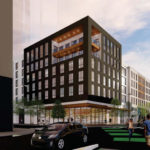
It reminds me of King St. near AT&T Park, That’s not necessarily a bad thing. This is better than most of the recent SF residential projects. The variation in the facades and window treatments along with the staggered rooflines is welcome. The rendering indicate sidewalk greenery above and beyond the de riguer tree which is also welcome. Finally, the sidewalks look to be pedestrian friendly and engaging – unlike say Hub 2.0. I’d much rather live here than in the Hub.
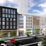
Hopefully, the hi-rises behind the project won’t overwhelm it but rather add to the overall feel with designs that are more than just another glass box.
Any updates on the timing for the huge new [wedge] park/plaza in this area?
What a nice touch. I was previously unaware of it. Thanks for the heads-up.
This plan shows that there is another large “wedge” shaped park on the Shipyard side of the development, plus another smaller wedge in Candlestick. Plus, the other hundreds of acres of parks along the waterfront.
I’m all for development but with that much additional homes and retail it is going to take 1 hr to get to South City or Burlingame from San Francisco. Good luck for those who move out there with kids – the wind is so bad they may be blown away.
Exactly. This is what is so screwed about new development, nobody cares about the big hit on quality of life for existing Bay Area residents from the increased traffic, traffic that our roads cannot handle. Externalized costs. They should force the developer plus a parcel tax to fund a free shuttle every 15 minutes from both the nearest BART and Caltrain in perpetuity, or even a light rail. Yes the general plan mentions transit but it is short on specifics.
There are externalized costs to not building, too. People need housing, so if the only type of housing permitted is sprawl, then that’s what we’ll get. The result is extreme housing costs, high transportation costs, environmental problems, and, yes, even a hit on quality of life from the increased traffic.
Maybe it’ll take longer to get to Burlingame by some forms of transportation, but that’ll be balanced by the additional destinations that will exist closer in–which will be more accessible by transit, etc, as well. It’ll be different, but not necessarily worse.
exactly, Prop O did not discuss the pay to develop aspect. They are ignoring the impacts of density…
And you, as is your wont, ignore the costs of sprawl.
Hint: the suburbanites don’t want the population, either.
Without a real transit solution this is just urban layered sprawl… 101 will be a disaster along with third at unless the rectify the transit and tax the prop O over development adequately from the start
Which causes more traffic, new housing here or new housing in Contra Costa County?
CCC? That’s so 1985!
“New Housing in Manteca”.
“Live Large in Lard…that two hour commute will be perfectly fun once autonomous vehicles take over!”
At this location, the new housing here will create unbearable traffic situations…. Reminder that you have multiple large projects, and a T-Line system built for maybe an 1/8 of that forcasted population…. Means you need to double up transit capacity (at a min.) ferry services to embarcadero or east and south bay locations, maybe the new ferry boats will be heavily used..?
Weak argument. How much overlap is there between people who would live in the Bayview and in Livermore, please. Sprawl is no longer an option in the close-in Bay Area, it’s already built out. Stop making excuses for pathetic urban planning, do the right thing and provide the needed transit connections!
Judging by the amount of asphalt, perhaps we call it the “La Brisbaneya Tar Pits”?
Honestly though, the whole approach to these developments is really retrograde – at the ideal moment for radical rethinking. Why not divvy up the space into 5 zones, and then bid out for ideas for each zone, then have the 5 winners sit together and come up with something resembling the actual neighborhoods we actually care about — none of which are these sterile manufactured vast wastelands from the likes of >insert huge developer here<?
How is it that the neighborhoods everyone loves and gravitates to date from before electricity, much less phones, much less iphones?
Neighborhoods usually form organically over time, with one lot at a time being built (or a hand full) by different designers, developers and builders. “Engineering” an entire neighborhood makes it sterile and cold.
Planned communities can be successful from the get go, but there’s a big difference between a community and a housing development.
@unlivable: which neighborhoods are you referring to?
I think that is as much a spatial issue as anything else. Those old neighborhoods are scaled to people and walking.
Exactly. They are often scaled to transit, but not in all cases.
What is up with the wide streets? There seem to be very few cars, and there are pedestrians crossing willy-nilly as if there was a four-way walk sign. King street has this level of pedestrian hostility because it connects the freeway to downtown. What is this connecting?
I guess they’re saving all the rock at Bayview Park (above Candlestick) for the new seawalls that will be needed next decade. Good plan. Then, once thats leveled, more space to develop.
Wide streets, promenades, big boxes…. Whatever, it’s not San Francisco.
We keep hearing about innovation and new urbanism pip dreams…. here’s a fresh canvas to go to town on and so far it looks sterile, and generic, and far from a urban city.
It’s Parkmerced and mission bay version 2-3-4 etc
More like not “old San Francisco” which has its plusses and minuses.
You can create density all you want and cram in as many people and businesses as you can, but if you expect the great majority of them to use a car to get around because it’s a transit desert then it’s the fault of the city and the developer.
Without any serious transit
Strange choice to render the high rises as gray translucent crystals. They nearly fade into the background especially in the last set of images. Why not allow them place making prominence?
Really? Have these painters ever been to the site? Instead of shorts and t-shirts, and exposed babies, the zombie figurines enjoying this arctic climate should be wearing parkas and fog gear.
transit transit transit
SFMTA and City need to start a real plan on improved T-Line services that route around on Cargo-Way all the way around to the new HSR and multi-modal facility inclusive of flipping the BRT to LRV on Geneva Harney. Water-Taxi’s and other systems will need to be developed inclusive even of a possible tram or other system.
The longer they wait the worse 101 will get…. and Third Ave….
If they don’t plan and pay up front we all get the resulting grid-lock
Please, the T still doesn’t connect to Bayshore Caltrain like it was supposed to do a decade ago when it opened.
Not even sure an extended T line is the solution here, but developers ignoring not only how people are expected to get to/from this place but also the huge impact additional cars will have on already congested roadways is not acceptable at all. Think of it this way. Grab a 2×4 block of housing in the avenues in the Sunset and look at car ownership and access to transit. I live on Rivera and it’s only 2 blocks to the L and take that to work downtown instead of my car. If the L is down I can walk to Noriega and take the bus, or the 66 to connect to the N line. This proposed development is completely alienated from public transit.
Don’t blame the developer(s) if you dislike new housing in this area, blame planning & County Board, they make the decisions on what can/should be build where.
I’m blaming both.
Who said I dislike new housing?
…in this area – you did: “…but developers ignoring not only how people are expected to get to/from this place but also the huge impact additional cars will have on already congested roadways is not acceptable at all.”
Wrong. I was talking about lack of transit access to development and potential impact the additional cars would have on area roads. I wrote nothing about being anti-housing.
Man, amazing how someone can twist a very simple explanation…
And just how do you expect developers to address transportation issue if they build housing?
You just don’t get it.
You don’t get it! The elected city/county officials and their hired help in the development department along with a few propositions determine how the land is to be developed and what development fees have to be paid. If the developer stays within these given parameters and pay the mandatory development/permit/UGM fees it is not his/her fault that the policies do not adequately address transportation. Place blame where it is due!
its time to widen 101 from SF to the airport. its already too congested
Nice plan. I wonder if the developers will be contributing money to enhance the neighboring state park. This could turn into one of the nicest parks in the city with the right touch.
Lol, the people who think this is an “arctic climate” have probably only been here at night for a game at the old candlestick park stadium. This is actually one of the warmest parts of the city. Think of it this way- you freeze your butt off sitting around at night for games in AT&T Park, but does that make South Beach an arctic climate too?
I see giant 4 lane streets with parking on both sides, no bulbouts or bike lanes. Is that really what we’re getting? At the very least, the median should be reserved for running Muni T line through the area to Bayshore.
Uber announced today that they will heavily reduce their footprint in Oakland. Instead, they will expand their office space in Mission Bay, next to the Chase Center. Bayview will be a very hip place 3-5 years from now.
Usually I would say Oakland needs all the business it can get – but losing Uber sounds like a blessing. If 1% of what Uber’s own employees say about them is true – Oakland is better off without them.
Why not a farm to grow the food necessary for those living in the region. We lose sight of where our food comes from at our own peril. Today we have given our food choices to Corporate Ag and they have poisoned our food supply with Monsanto’s BT Corn. Be nice to see hemp fields with a hemp material manufacturing plant, alongside orchards and Permaculture designed food systems. Tons of housing means tons of people needing to eat. Let’s really design sustainability into the area by attempting to make all necessities home grown!
Not a good place for growing plants. The climate is too cool here. If you’re looking for an ideal climate for farming, head 40 miles south to Santa Clara county.
However it is a great place to develop residential and commercial buildings given the strong demand for close-in housing and office space. That would put a dent in the sprawl that is paving over much better farmland in Brentwood and Tracy.
Except that the Brentwood farmland-turned-housing development makes is somewhat more affordable for people to live.
There is the map shown if well planned you can run the Geneva Harney route out along this area, out and around Cargo Way, and provide a couple pier locations for ferry services, than with the India Basin plans and project there may be a better pedestrian and bike route downtown…. But we got to plan the LRV option at Schlage Lock Factory, Brisbane Development and out along the prior Candlestick route now, and not later post Prop O developments….